Tripy RiverNotes 2 Roadbook Editor Software

RiverNotes 2 is an electronic and paper roadbook editor in high-definition color, designed for creating rally roadbooks or tourist itineraries. Combining the power of a vector editor with an interface that synchronizes all the data needed for roadbook production—maps, GPS tracks, symbol libraries, note editor, waypoint attributes, metadata—this software is the ultimate reference for motorsport enthusiasts, clubs, tour operators, and rally professionals.

RiverNotes 2 is a major evolution of the RoadTracer Pro software—a black-and-white bitmap roadbook editor introduced in 2005—which it replaces and surpasses.

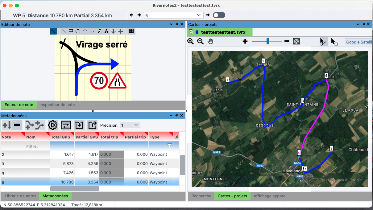
A SMOOTH GRAPHICAL EDITOR.


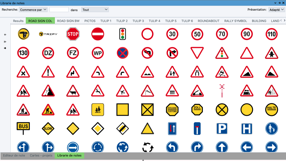
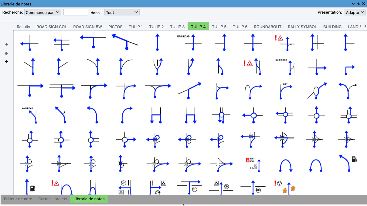
RN2  offers floating palettes and customizable symbol libraries, with keyword-based search for drawings.

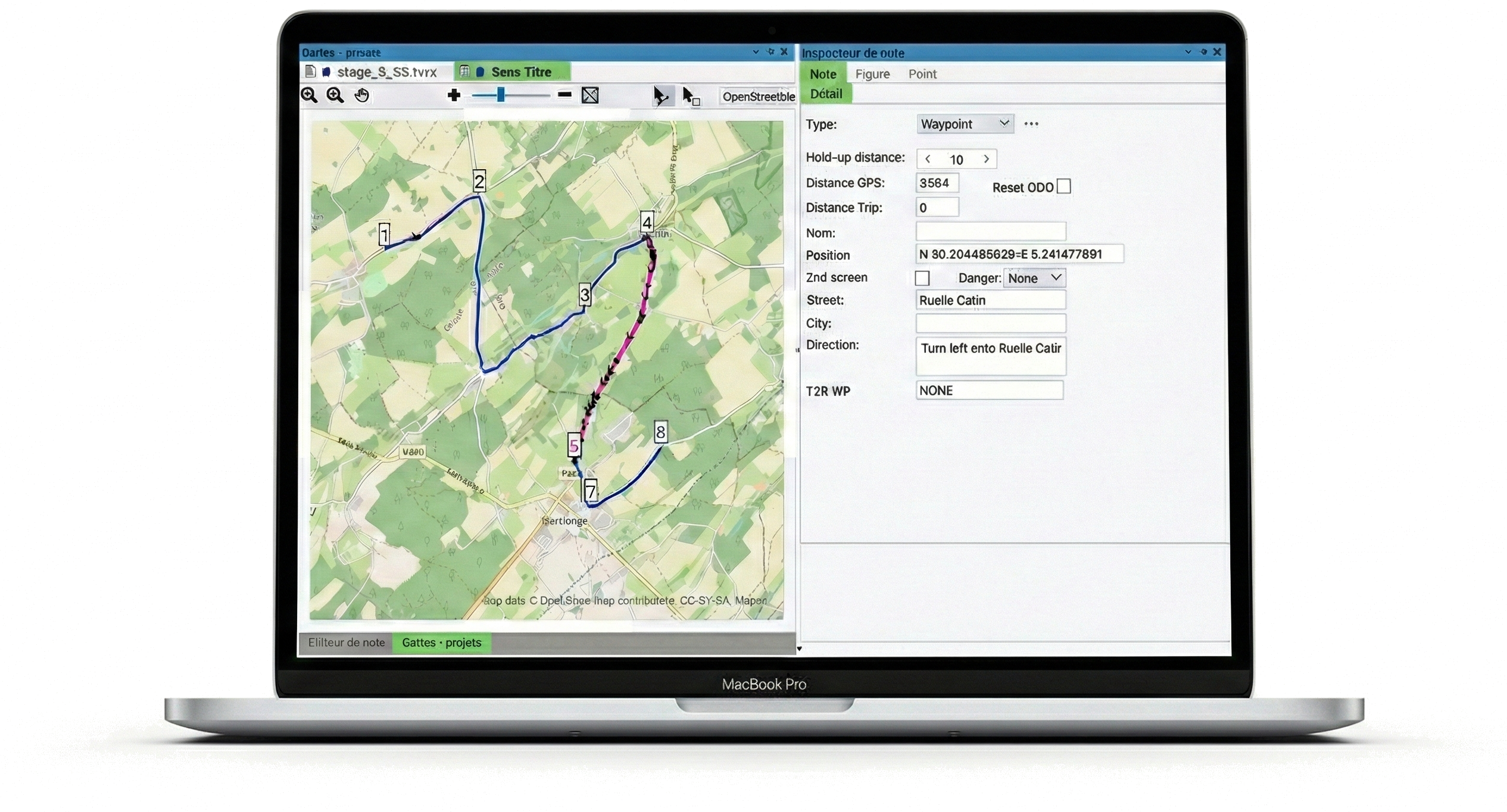
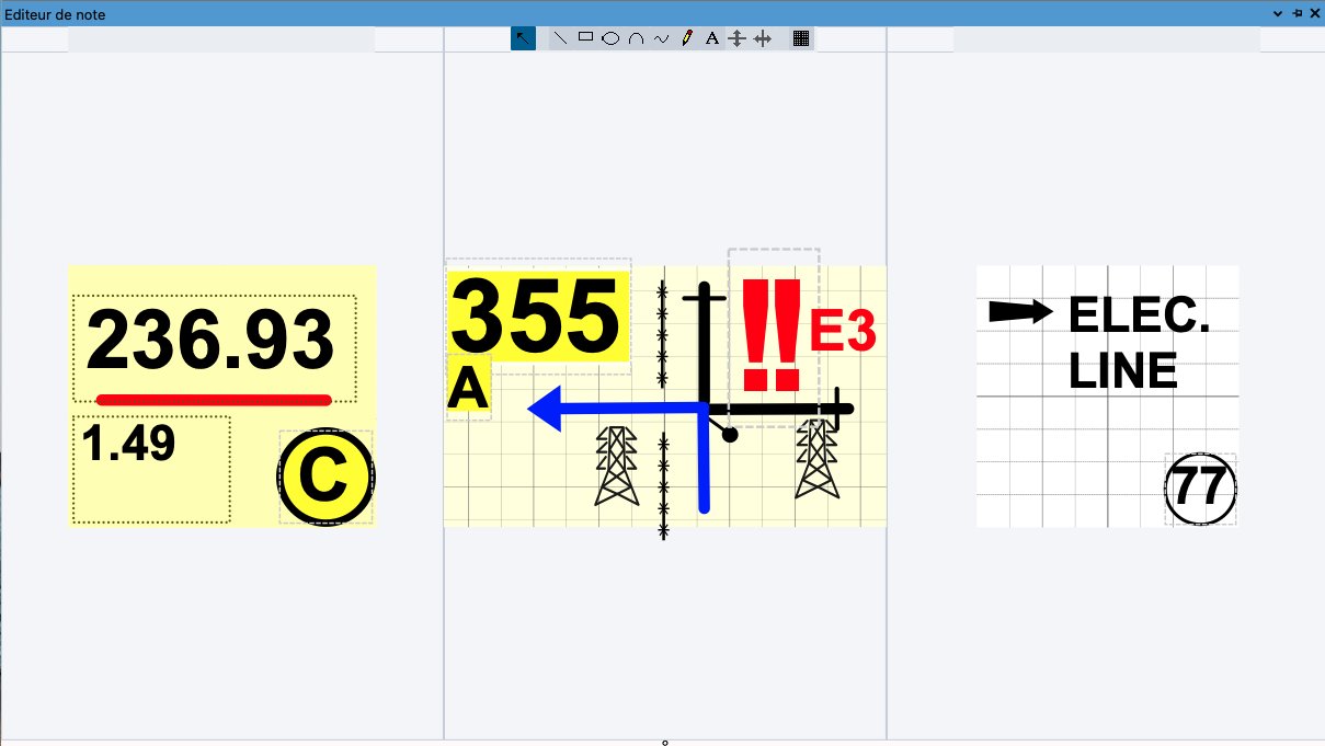
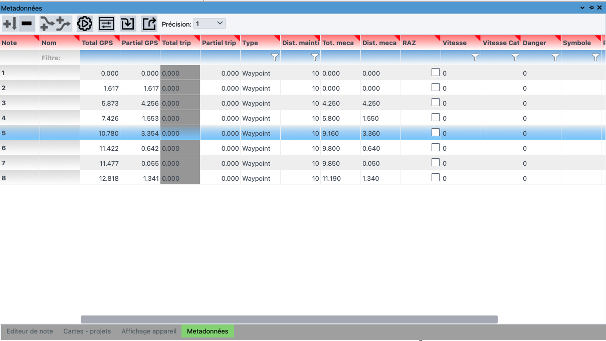
SMART WAYPOINT ATTRIBUTES.


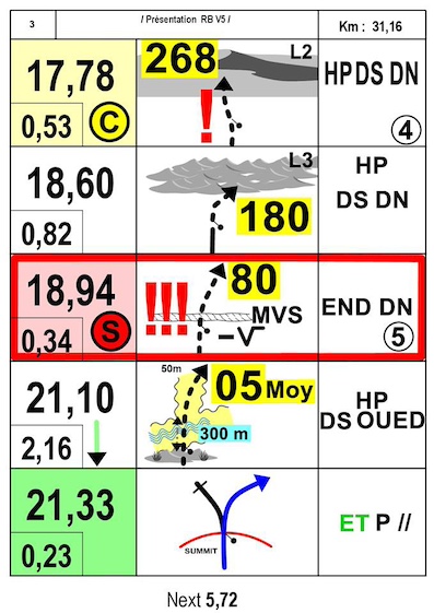
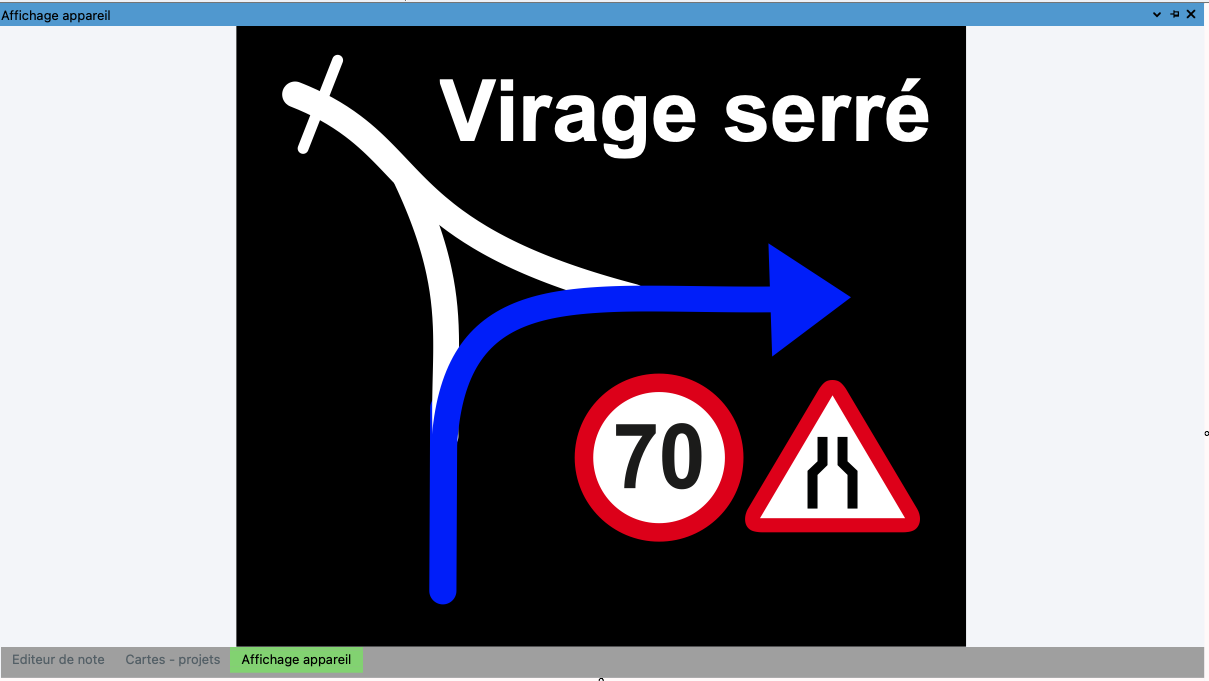
RN2 automatically enhances your notes using the FIA layer, active according to the selected waypoint attributes: DANGERS-CP-CH-WPM-WPE-CHRONO, DZ, FZ, etc., editing their respective color codes and symbols.

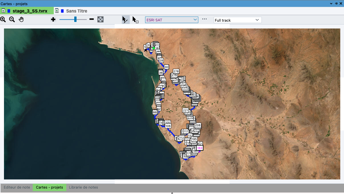
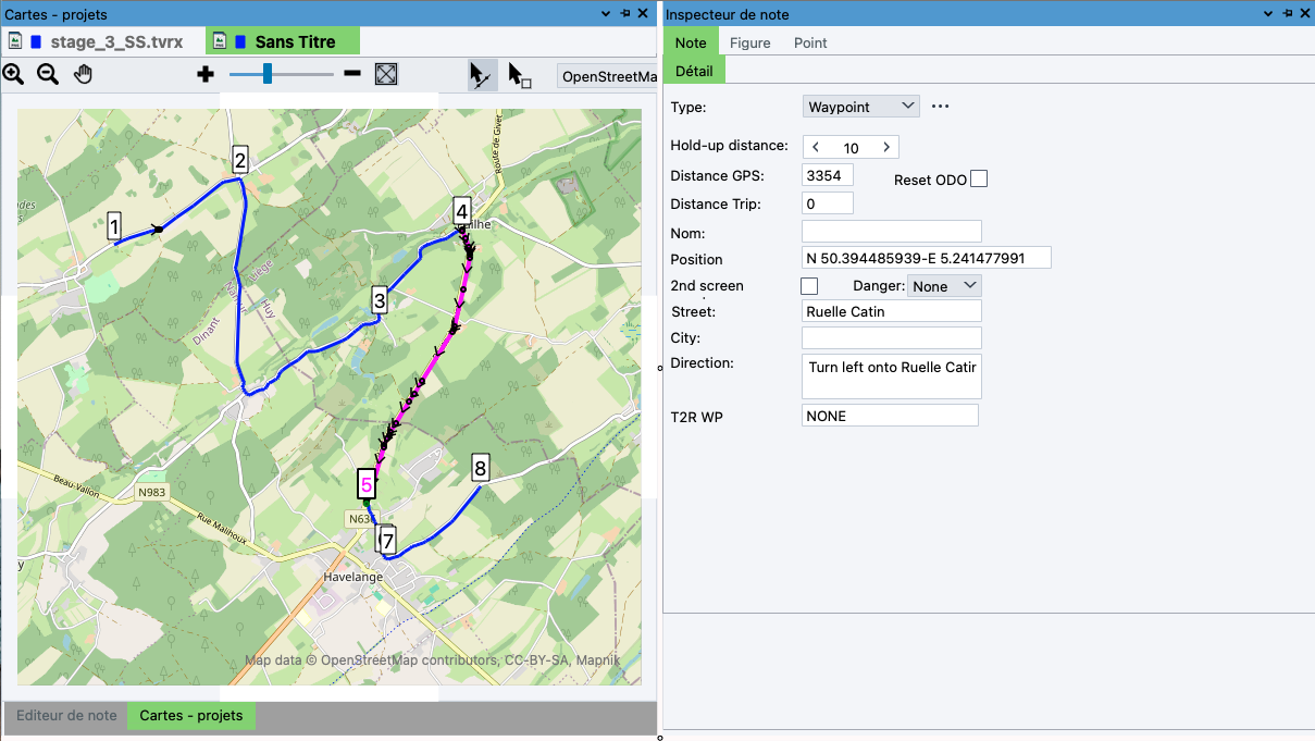
ADVANCED PROJECT MANAGEMENT.


RN2 consolidates multiple files in a single project, including maps, routes, GPS tracks, notes, waypoints, and roadbooks for your events.

GLOBAL MAPPING.

RN2 comes with an active OpenStreetMap by default. Other maps Bing, Google, Here, MapBox, TomTom, can be activated in the Cloud.

AUTOMATIC ROUTING.

RN2 automatically generates notes with ball-arrow symbols for each intersection, which can be customized, printed, and exported in GPX, KML, TRB, TVR, TVRX, OPENRALLY, CSV formats

PERFECT

RN2 synchronizes all elements of a roadbook: maps, annotations, tracks, waypoints, notes, and metadata.

RiverNotes 2 - RALLYE PRO FIA -
The vector roadbook editor for rally and rally-raid professionals.

RiverNotes 2 - CLUB -
The roadbook editor for enthusiasts who also want to print them in color.

RiverNotes 2 - COMPANION -
The roadbook editor for users who want to customize their creations.

Functions COMPANION CLUB RALLY PRO FIA
Open all RiverNotes 2 roadbooks (tvrx) from any version of RiverNotes 2 🚫
Open RiverNotes 2 roadbooks (tvrx) from RiverNotes Companion and TripyMAP
Create a new roadbook
Create and open a project 🚫 🚫
Import a file from an older Tripy version, a GPX, KML, Garmin GDB file or a Tripy-3 recording
Import a CSV or Satinfo file 🚫 🚫
Export GPX, KML, Tripy-II
Export CSV, Rally Control, Tripy-K, T2R, Terrain, Altitude, Sportive WP, TerraPirata, ERTF 🚫 🚫
Display of OSM worldwide map
Access to other online map layers (paid or free depending on the providers)
Display of the elevation profile of the route
Display of the track on Google Earth
View StreetView at a position on the track (requires a Google Maps API key)
Display of a track by sections (using the "SECTION" metadata) 🚫 🚫
Access to metadata 🚫 🚫
Automatic FIA filter 🚫 🚫
Create a track by point picking
Management of waypoint types in the inspector (and display of WP-related data) 🚫 🚫
Track editing (add/remove point, add/remove waypoint note, selection, copy/paste, …)
Ability to draw in 3 boxes per roadbook line for printing (e.g. FIA cross-country roadbook) 🚫 🚫
Ability to manage print options, print templates and print a roadbook 🚫
Search by city, position, distance on the track
FIA and rally symbol libraries already included 🚫 🚫
FIA and regularity print reports 🚫 🚫